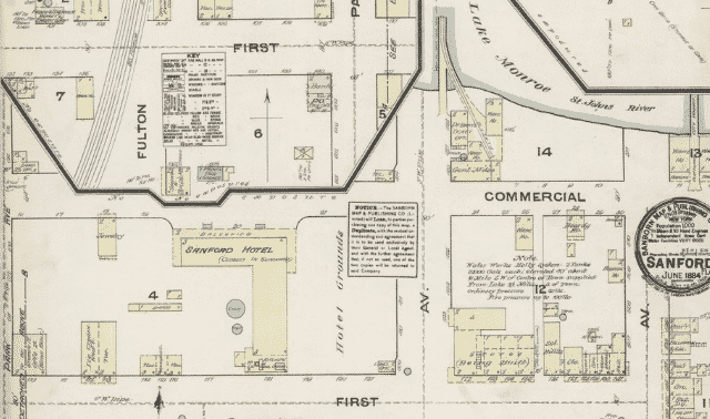
Have you heard about the Library of Congress’ digital Sanborn maps? Nearly 25,000 maps are online, with more to be added over the next three years, for a total of 500,000.
Sanborn fire insurance maps were published for insurance companies to assess a structure’s risk of catching fire. They were published in different years for different places, and usually after 1920, a set of maps for a particular town might be updated by pasting over a new building.
The maps show subdivision names, streets, buildings, and building details such as address, purpose, composition, windows and doors. You can locate your ancestor’s address before renumbering and renaming that might’ve happened, and you get a good look at your ancestor’s neighborhood at the time.
Here’s an example of how I used the collection to see where my ancestors lived:
1. Search for city maps
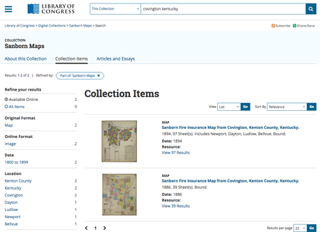
Much of my mom’s family lived in Covington, Ky., so that’s what I searched for (typing the full state name) in the Search box at the top of the page. Maps were published in 1886 and 1894 (I chose 1886).
2. Use city directories to find specific addresses
Next, I looked up a few ancestors’ addresses in city directories. In 1886, Louis Thoss lived and worked at a hardware business at 73 E. 12th st. His mother, Elizabeth, was a widow at the southeast corner (“sec”) of 13th and Garrard. His deceased brother’s widow, Jennie, lived at 165 E. 13th.
3. Explore indexes
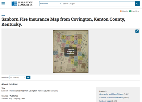
Zoom in on the index map and drag it around to get a better look at street names.
For larger cities, check the last page in the series for a street index that lists which range of house numbers and the map page they’re located on. It also lists “specials,” or major buildings.
The corner of East 13th and Garrard is on Map 30. Jennie’s address on East 13th could be on map 29 or 30.
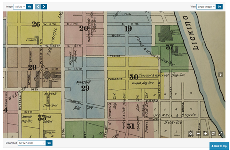
I Googled Louis’ address to get a better idea of its location today. It’s probably on Map 20, but might be on a different map if houses have been renumbered since Louis’ day.
4. View singe images or galleries
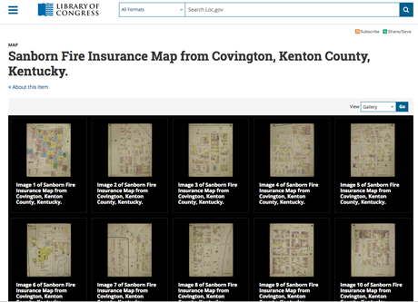
At the top right of the web page, switching from single image to gallery view and clicking Go gets me to the view of all map pages in this set, so I can find and click image 30.
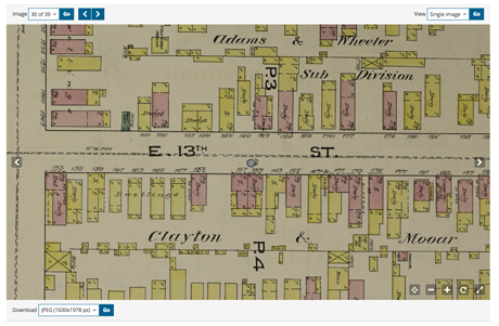
Here’s where it helps to check a Google map if you don’t know the area. Thirteenth street was shown running north/south, because it was probably positioned horizontally on the page. But in real life, it runs east/west. If I didn’t know that, I’d pick the wrong corner of 13th and Garrard. You can rotate the map using controls in the lower right corner.
Elizabeth Thoss lived at No. 133. No. 165 is 11 doors to the east.
5. Learn from colors and symbols
Elizabeth’s home is mostly pink and some yellow, with numbers and Xs, and the notation “no opgs” on the side. You’ll find a key on the index map page and more information about the colors and symbols here, along with notes such as the area’s population and size of the fire department.
Colors indicate construction materials. Green indicated a high-risk building. The numbers tell how many stories. An X marks a door, and Xes on walls mark windows, with dots for windows on second or higher stories. An O is an iron chimney. Elizabeth’s building was mostly brick (pink) and 2-½ stories, with a 2-story wood (yellow) addition. The front section held a saloon (“sal”), with a dwelling (“Dwg”) in the rear.
6. Download maps for future research
You can download this map in several formats, all the way up to a TIF, using the Download menu at the lower left.
If you’re looking in New York City, you can use the New York Public Library’s Map Warper to view Sanborn and other old maps layered over modern maps. If not, you can upload your map to Google Earth and do an overlay there. Find a tutorial in the July/August 2015 issue of Family Tree Magazine.
No comments:
Post a Comment